
The Intermountain West region is currently facing increasing pressures from climate change, hydroclimatic extremes, and increasing water demands associated with population growth and industry changes. As such, there is an urgent need to understand how water hazards in the region are being managed, who is managing these hazards, and how to facilitate better future planning. Additionally, we are interested in who is involved with various aspects of water management, the role of compound and cascading hazards, the impact of informal and formal policy, and identifying best practices. Below we describe our various efforts involved with this project.
This project has received financial support from the Intermountain West Transformation Network, funded by the National Science Foundation under grant #2115169. The Intermountain West Transformation Network aims to support convergent research and education that will advance sustainable regional systems science, engineering, and education.
Bailey Holdaway, PhD Student, USU
Dr. Gina Gilson, Assistant Professor, USU
Dr. Richard Rushforth, Associate Professor, ASU
Emergency Manager Water Hazard Management Survey
One aspect of water hazard management we are interested in understanding is the role that county emergency managers have in water-related hazard management. We will be surveying emergency managers in the Intermountain West starting in late Spring 2026. We will be reaching out to emergency managers through email, phone call, mail (see postcard invitation below in Figure 1). Managers have the option to take the survey online or on paper. Stay tuned for our survey findings! If you are an emergency manager in the region, feel free to reach out to the research team with questions (bailey.holdaway@usu.edu).

Figure 1. Emergency manager survey postcard invitation
Preliminary Findings


Water Hazard Matrix
Many complex environmental issues are often assessed and understood through the creation of a compound index that can help simplify complex issues down to a single value. However, while these indices can help provide clarity in some instances, they can also dilute nuance and mask on-the-ground specificity. One method that can be used as an alternative to an index is to use a matrix.
We have used a matrix to showcase a wide-range of water-related hazard data in the Intermountain West (Figure 2). This matrix includes data like population estimates, elevation, % burn, primary land cover type, and more all at the HUC8 watershed level. This matrix allows us to holistically see all watersheds within the region while being able compare various data.
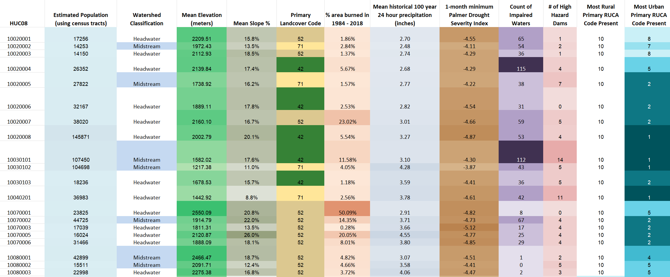
Figure 2. Preliminary water-related hazard matrix
Picture Credits: Utah Public Radio, Parcels Aplenty, and Utah News Dispatch.