Where do these organizations work?
We have mapped the HUC-8 watersheds that have been mentioned explicitly (Figure 1) in our interviews and web-searches as well as their more generalized coverage (Figure 2) across the region. Depending on how you interpret the information provided by river and watershed organization representatives, you get a different impression of their watershed coverage. It should be noted that not all of the organizations we are studying work at the watershed scale. We have aggregated information to the HUC-8 level.
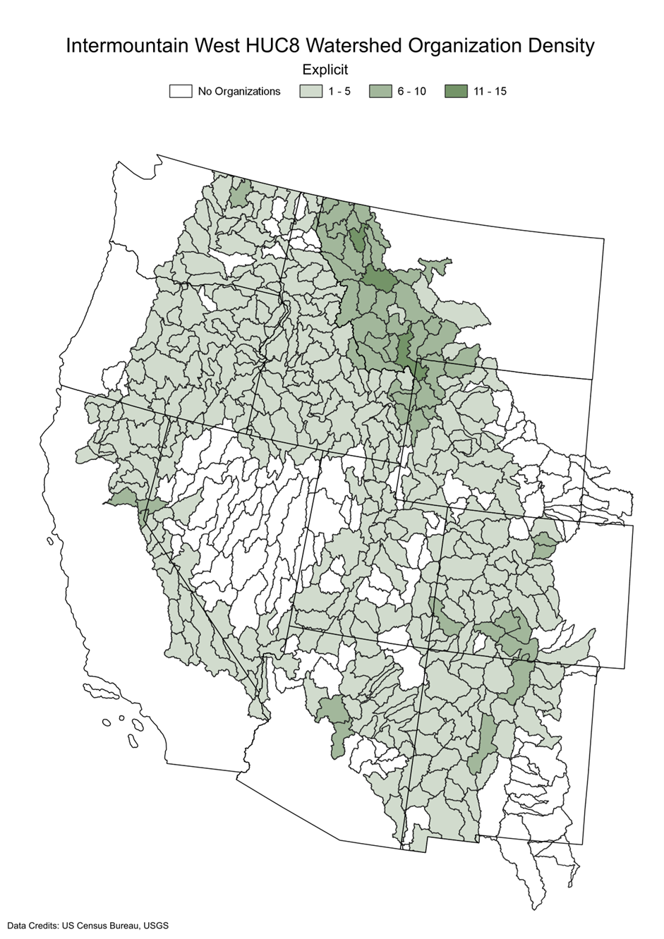
Figure 1: Map of the Intermountain West showing USGS HUC8 watersheds by density of organizations that explicitly said where they are working in the Intermountain West. Legend categories are: No organizations, 1-5 organizations, 6-10 organizations, and 11-15 organizations. Data credits from US Census Bureau and USGS.
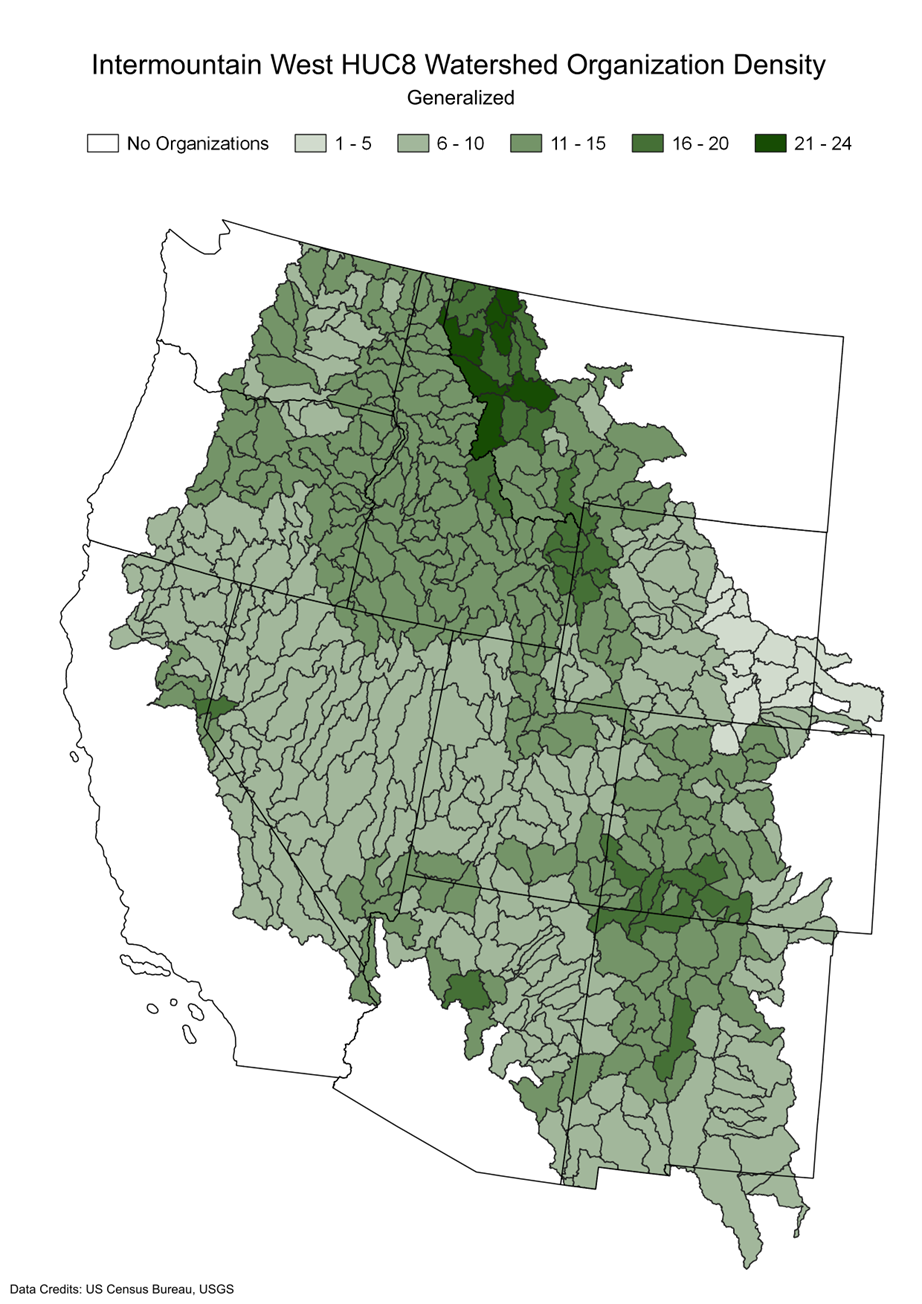
Figure 2: Map of the Intermountain West showing USGS HUC8 watersheds by density of organizations that generally said where they are working in the Intermountain West. Legend categories are: No organizations, 1-5 organizations, 6-10 organizations, 11-15 organizations, 16-20 organizations, and 21-24 organizations. Data credits from US Census Bureau and USGS.